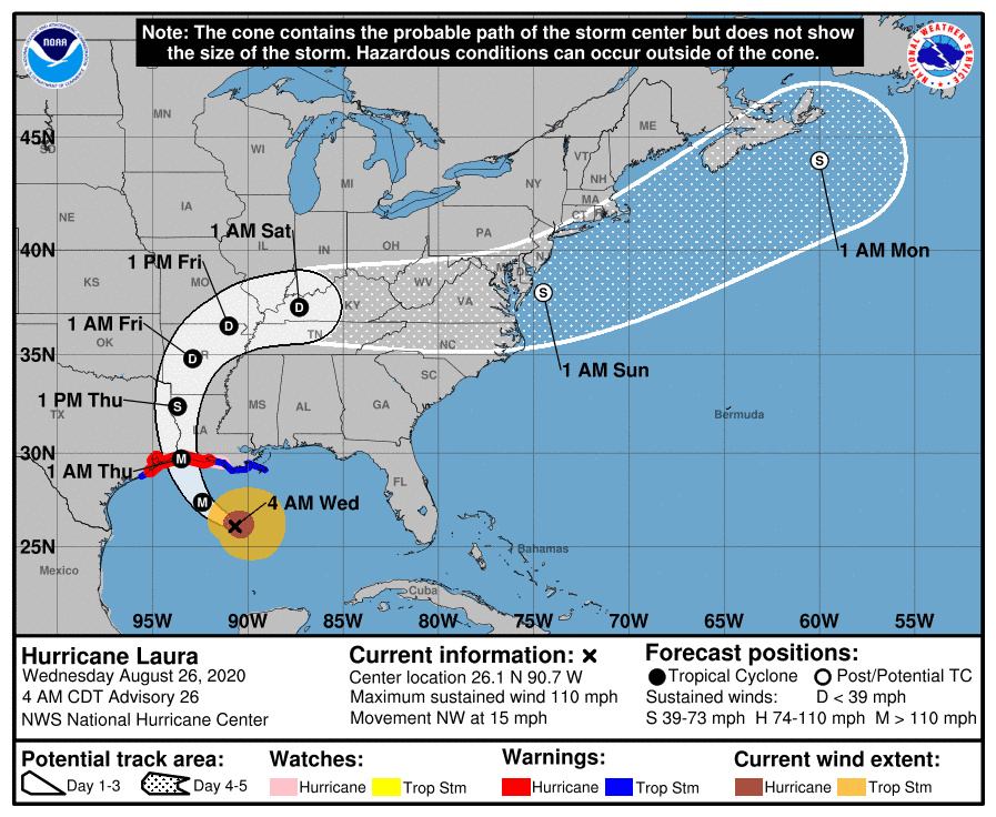
Hurricane Laura is expected to make landfall late Wednesday/early Thursday on the Gulf Coast near the border of Texas and Louisiana as a major Category 4 storm.

WDSU reports: “Tropical-force winds extend outward up to 175 miles. It is expected to be the first major hurricane of the 2020 Atlantic hurricane season. Benjamin Shot with the National Weather Service said the storm surge could be life-threatening, if not ‘downright catastrophic' to coastal areas. All of coastal Louisiana should brace for a storm surge, he added.”
“A Tropical Storm Watch has been issued for several parishes in southeast Louisiana, including Terrebonne, Lafourche, lower Plaquemines and lower Jefferson,” WDSU adds. “A Hurricane Watch is in effect from south of Port Bolivar to San Luis Pass, Texas, to Morgan City, Louisiana. A Storm Surge Warning is in effect from San Luis Pass, Texas to the mouth of the Mississippi River. A Storm Surge Watch is in effect from the mouth of the Mississippi River to Ocean Springs, Mississippi, and includes Lake Pontchartrain, Lake Maurepas and Lake Borgne.”
Mandatory evacuation orders have been put in place along the Texas coast.